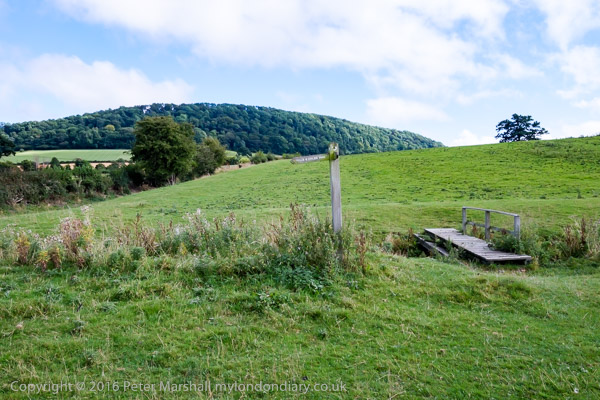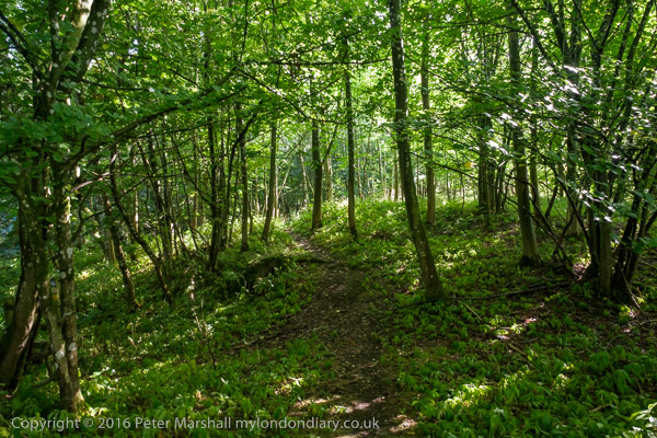
I continued around the camp on a permissive track to mee a footpath
to the west of it, and looked for the path down the hill
It simply wasn't there. Just a fence stopping people falling down a
very steep slope
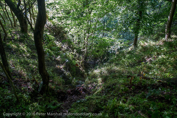
I tried to follow the footpath pack to meet the path I had come up on,
but again no path was visible
I struggled through undergrowth for several hundred yards, then made
my way back to the camp at the top of the hill
and walked around its edge back to where I had come in. It should have
been easy to retrace my steps from there,
but I failed to find any trace of the path I had come up. I was on a
good track so I kept walking; according to the OS
map that track ended at another path. By now it was pouring with rain,
but my umbrella was keeping me reasonably
dry. Back at home I was able to follow my path from a GPS trace, which
I've superimposed on the OS Map.
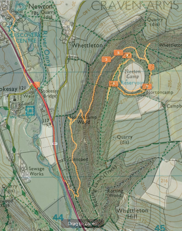
I didn't take many pictures - it was raining hard much of the time and
I was getting pretty worried
. Lightroom has located the pictures correctly but numbered them wrong
and missing several pictures. The trace starts at top right, and I made
my way down and around Norton Camp taking three pictures. I then searched
for the path down the slope (at one of the three 3's on the trace) without
success, walking a little further south and then coming back and trying
to follow the path north. It disappeared and you can see I wandered
off it to the right trying to find a way through and eventuallly reaching
the camp. I then returned and again lost the path going back to walk
inside the camp around the edge of the open area back to Nortoncamp.
I started back along a track, going past the path I wanted, carrying
along to the photo marker 5. (meaning there are 5 images on the track
here - but in fact not here as I had the time set on one camera an hour
out). A little further south the OS map shows a path crossing the track
but there was no sign of it on the ground at this point
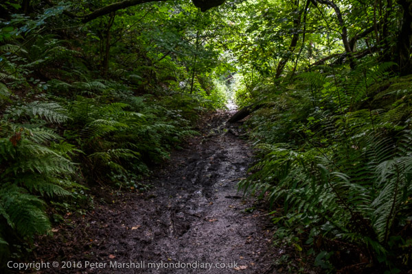
Several hundred yards later I followed a couple of paths that seemed
to be going in the correct direction, getting within a few yards of
one of the marked paths - but both ended in impenetrable brambles etc,
and I gave up, returning to a clear track thorugh the wood.. Fortunately
the rain had stopped but. the downhill slopes were by now running with
water and slippery clay. I finally emerged onto the old carriageway
of the A49 and though I could have taken a footpath decided to walk
onto the main road and take that back across Stokesay Bridge and walk
back into Craven Arms via the Doscovery Centre.
A walk that should have been simple had taken me several miles out
of my way - and around an hour and a half longer than expected. Fortunately
I had started in plenty of time and was back well before it got dark.
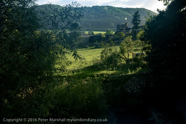
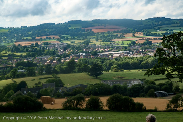
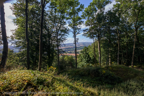
A view of Stokesay cCastle in the distance from the A 49
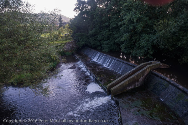
and the weir on the River Onny
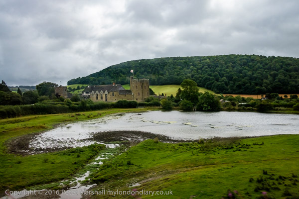
The following morning we were on our way home - in light drizzle. I
snatched a last picture of Stokesay a few
seconds after we had boarded our train. It was running around ten minutes
late, so we missed our connection
and seat reservations at Newport by 2 minutes. Before privatisation
that connection would have been held for us,
but now the two services are run by different companies and there is
no cooperation like that and we had a
wait of over an hour for the next train. Fortunately we go seats despite
having no reservation on the service.
And because they were spearate companies, alhtough our journey was
delayed for an hour we can claim no
compensation. The Arriva train was only 10 minutes late and the First
Great Western service ran to time.
but our journey still took an hour more than it should.
|